Revolutionizing Land Management: Predulive Labs' Drone Technology for Land Digitization
In the age of digital transformation, the digitization of land records and efficient land management are essential for sustainable development and economic growth. Predulive Labs, a leader in drone technology, is at the forefront of driving innovation in this domain. By harnessing the power of drones, Predulive Labs is revolutionizing land management through its innovative solutions for land digitization. Let's explore how Predulive Labs' drone technology is reshaping the landscape of land management and paving the way for a more efficient and transparent system.
The Need for Land Digitization
Traditional methods of land record-keeping are often cumbersome, time-consuming, and prone to errors. Manual surveys and paper-based records pose challenges in terms of accuracy, accessibility, and maintenance. Moreover, outdated land management practices hinder effective decision-making and impede sustainable development initiatives. Recognizing these challenges, Predulive Labs seeks to modernize land management processes through the adoption of drone technology.
Leveraging Drone Technology for Land Digitization
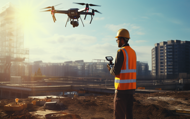
Predulive Labs' drones offer a powerful tool for land digitization, enabling rapid and accurate data collection over large areas. Equipped with advanced cameras, sensors, and GPS technology, these drones capture high-resolution imagery and precise geospatial data with unprecedented efficiency. By conducting aerial surveys and mapping exercises, Predulive Labs' drones facilitate the creation of detailed digital maps and land records, laying the foundation for a comprehensive land management system.
Key Features of Predulive Labs' Drone Solutions
Predulive Labs' drone technology offers a range of features tailored to the needs of land digitization and management:
1-High-Resolution Imaging: Predulive Labs' drones are equipped with advanced cameras capable of capturing not only high-resolution imagery but also aerial videos, allowing for comprehensive documentation and analysis of land features and changes over time.
2-Real-Time Monitoring: Predulive Labs' drone solutions offer real-time monitoring capabilities, enabling stakeholders to receive live feeds and updates during surveying and mapping operations. This feature is particularly useful for situational awareness and rapid response in emergency situations.
3-Environmental Sensing: Beyond visual imaging, Predulive Labs' drones integrate environmental sensors to measure parameters such as air quality, temperature, and humidity. This environmental data provides valuable insights into ecosystem health and helps in assessing the impact of land management activities on the environment.
4-3D Mapping and Modeling: Predulive Labs' drones are capable of generating 3D maps and models of land areas, buildings, and infrastructure using photogrammetry and LiDAR (Light Detection and Ranging) technology. These 3D models enhance spatial visualization and support advanced analysis for urban planning, infrastructure development, and architectural design.
6-Data Fusion and Integration: Predulive Labs' drone solutions facilitate the fusion and integration of data from multiple sources, including aerial imagery, satellite imagery, ground surveys, and existing GIS databases. This data integration enables comprehensive analysis and decision-making for land management and development projects.
7-Secure Data Storage and Sharing: Predulive Labs prioritizes data security and privacy by providing secure storage solutions for drone-captured data and implementing encryption protocols for data transmission. Additionally, the company offers user-friendly platforms for sharing and collaboration, ensuring controlled access to sensitive information.
Applications Across Land Management
Predulive Labs' drone solutions find diverse applications across various aspects of land management:
1-Land Surveying and Mapping: Drones enable efficient land surveying and mapping, facilitating the creation of cadastral maps, property boundaries, and land-use maps for urban planning and development projects.
2-Land Title Registration: By digitizing land records and establishing a centralized database, Predulive Labs' drone technology simplifies the process of land title registration and ensures transparency and accuracy in property transactions.
3-Natural Resource Management: Drones aid in monitoring and managing natural resources such as forests, water bodies, and agricultural land, supporting sustainable land use practices and environmental conservation efforts.
4-Disaster Risk Assessment: In disaster-prone areas, drones provide valuable data for assessing land vulnerability, identifying high-risk zones, and planning mitigation measures to reduce the impact of natural disasters.
Advantages of Predulive Labs' Drone Solutions
The adoption of Predulive Labs' drone technology for land digitization offers several advantages:
1-Cost-Effectiveness: Drones significantly reduce the cost and time required for land surveys and mapping activities compared to traditional methods, making land digitization more accessible and affordable.
2-Improved Accuracy and Efficiency: The precision and efficiency of drone-based data collection result in more accurate and up-to-date land records, enabling better decision-making and resource allocation.
3-Enhanced Accessibility: By digitizing land records and making them accessible online, Predulive Labs' drone solutions promote transparency and accountability in land management processes, empowering stakeholders with timely and reliable information.
4-Scalability and Flexibility: Predulive Labs' drone technology is scalable and adaptable to diverse land management needs, from small-scale property surveys to large-scale land-use planning projects.
Predulive Labs: Competes with expertise in AI, machine vision and drone technology, offering customizable industry-specific solutions with a focus on data accuracy, security and regulatory compliance.
Conclusion:
Predulive Labs' drone technology is driving a paradigm shift in land management by enabling the digitization of land records and the implementation of efficient land management solutions. By leveraging drones for aerial surveys, mapping, and remote sensing applications, Predulive Labs is empowering governments, land administrators, and other stakeholders to make informed decisions, streamline processes, and promote sustainable land use practices. As we embrace the digital era, the adoption of drone technology for land digitization holds the promise of creating a more transparent, efficient, and equitable land management system for the benefit of society as a whole.